Header Map
Home Page
 
Fixtures
 
Orienteering At Anytime
 
EPOC Results
 
EPOC Photo Album
 
EPOC Route Gadget
 
YHOA Competitions
 
YHOA Juniors
 
Safeguarding Information
 
Beginners Guide
 
Joining EPOC?
 
Membership Info
 
Club Training/Coaching
 
EPOC Epistles
 
British Orienteering Information
 
Contact Club Officials
 
EPOC Club Constitution and Policies
 
Runs, Walks and Rides
 
FAQ
 
Other Links
 

Instagram LogoEPOC Twitter

Instagram LogoEPOC Instagram

Facebook LogoEPOC Facebook

Dewsbury Flyer
Golcar Snippet

Dewsbury Urban Event

YHOA Urban League

 Sunday 11th June 2017

Final Details (9 June 2017)

Golcar Snippet

EPOC are pleased to invite you to orienteer around the varied urban environment of Dewsbury Town Centre and Crow Nest Park.


Terrain: The terrain is mainly Tarmac and includes part of Crow Nest Park and the buildings of St John Fisher Voluntary Academy.


Map: New map A3 1:5000 with 5m contours - Surveyed and drawn by Richard Payne 2017.


Registration: St John Fisher Catholic Voluntary Academy, Oxford Road, 10.00am to 12.00. Toilets and changing. Streetmap WF13 4LL


St John Fisher Voluntary Academy. Will be signed from the A644 in Ravensthorpe Streetmap


Starts: 10.30am to 12.30am. The route to the start will be taped and is about 10 minutes walk from registration.

Leave the car park to the North by the same entrance that you came in when you arrived, turn right along Oxford Road for 175mts and follow red and white taped route. 


Control Descriptions will be available at -3 in the Start Lanes and on the map.

The route to the start, for all competitors, involves a road crossing which will not be marshalled. The road is in a 30mph restriction and there is a traffic island to facilitate safe crossing.


Parking: in School grounds, Oxford Road and on adjacent streets.


Entries and Fees: Senior: £8.00 (non BO members £10.00). Si Dibber Hire £1

Juniors: £3.00 Si Dibber Hire £1.

Course 7 Yellow, Free to enter but 50p for each additional map and £1 for dibber hire.


Course

Length,km

Climb,mts

Controls

Urban

Category

Men

Urban

Category

Women

1 Black


MO

Men Open   (M18-35)


2 Brown


MV

Men Vets (M40+)

WO

Women Open (W18-35)

3 Blue


MSV

Men Super Vets (M55+) 

WV

Women Vets (W40+)

4 Green


MUV

Men Ultra Vet (M65+)

WSV

Super Vet Women (W55+) 

5 Short Green


MHV

Men Hyper Vets (M75+)

WUV

WHV

Women Ultra Vets (W65+)
Women Hyper Vet (W75+)

6 Light Green


MJ

Junior Men (M16-)

WJ

Junior Women   (W16-)

7 Yellow


MYJ

Young Junior Men (M12-)

WYJ

Young Junior Women  (W12-)


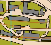
Safety:  Whilst we have carried out full risk assessments of the competition areas and put in place mitigation of the risks we have found, please be aware that you take part at your own risk. Competitors will be responsible for their own safety.
Please be aware of all traffic, pedestrians and other competitors. It is a good principle, to pass other runners to the left. The courses pass through all types of urban environment with a wide range of underfoot conditions. Wet Yorkshire pavements and cobbles are very slippery as are the flags and grass. Competitors who are travelling alone are advised to leave named car keys at enquiries. All competitors must download as soon as possible at the end of their run whether they have completed the course or not.

Planner’s Comments:

The route to the start, for all competitors, involves a road crossing which will not be marshalled. The road is in a 30 mph restriction and there is a traffic island to facilitate safe crossing.

The yellow (M/W 12-) course crosses two roads. The first will be marshalled and the second will involve a one-minute timed crossing, which will be also marshalled. In addition to these two crossings the Light Green course (M16-) will cross a 30 mph restriction road twice in the early part of the course.  Please take extra care as this will not be marshalled.

Courses Green to Brown cross a busy ring road twice and can do so at either of two mandatory crossing points. The first is via an overpass and the other via the Station Bridge. When using the station route competitors are asked to take particular care both in relation to themselves and passenger users. When using the station route from North to South take care as you exit the station as you may encounter traffic using the station car park. This station route involves crossing the ring road itself. The marked crossing point is at a Pelican crossing with a traffic island in the middle of the road.


Organiser: Jean Lochhead EPOC 

Planner: Richard Payne EPOC

Controller: Martyn Broadest AIRE

© East Pennine Orienteering Club
Page updated: February 06 2018
Webmaster:
Any comments regarding this website will be thoughtfully received!